
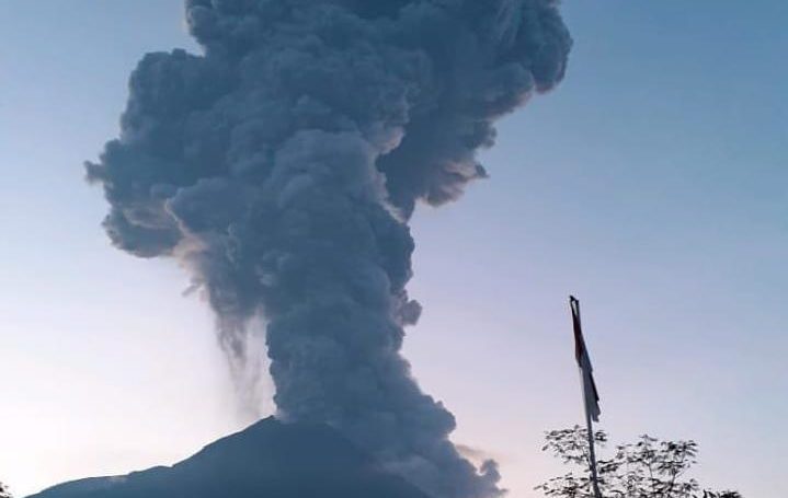
Mount Merapi erupted again at 05.22 WIB, Tuesday (3/3). The Agency for Investigation and Development of Geological Disaster Technology (BPPTKG) mentioned an eruption in a seismogram with an amplitude of 75 millimeters and a duration of 450 seconds.
BPPTKG also observed the eruption column height ± 6,000 meters from the peak and the hot clouds falling towards the upstream K. Gendol with a maximum distance of 2 kilometers. The direction of the wind when the eruption goes north.
The mountain on the border of Central Java-Special region of Yogyakarta is still level 2 or vigilant since 21 May 2018.
BPPTKG encourages people to stay calm and active as usual outside the 3-kilometer radius of the summit of Merapi, as well as anticipate the disturbance caused by volcanic ash.
https://twitter.com/BPPTKG/status/1234614940985507840?ref_src=twsrc%5Etfw%7Ctwcamp%5Etweetembed%7Ctwterm%5E1234614940985507840&ref_url=https%3A%2F%2Fwww.cnnindonesia.com%2Fnasional%2F20200303065531-20-479955%2Fgunung-merapi-erupsi-tinggi-kolom-abu-6000-meter
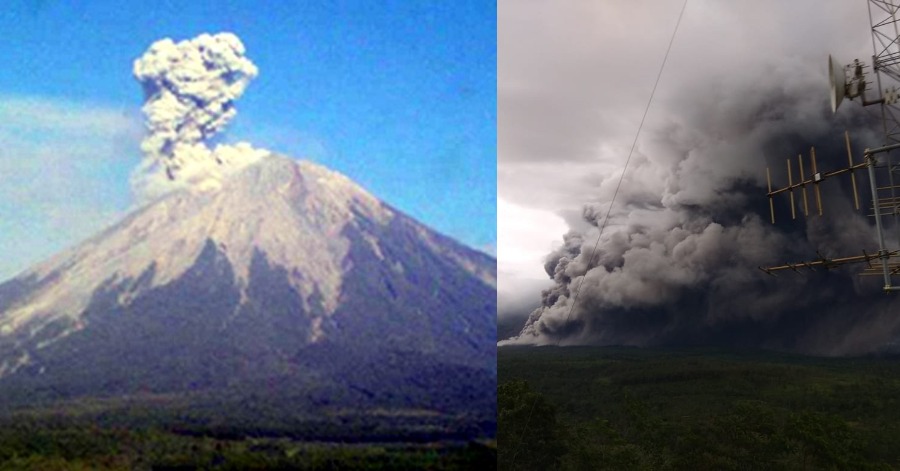
This eruption is not the first time. Before this, Merapi also erupted on 13 February 2020. But the eruption was believed to be larger than before.
On the previous eruption, people were encouraged not to do any activity within a radius of 3 kilometers from Mount Merapi. It is because the potential appearance of hot clouds lava until volcanic material remains to be wary even though the eruption has stopped.
Source: CNN Indonesia


Leave a Comment