
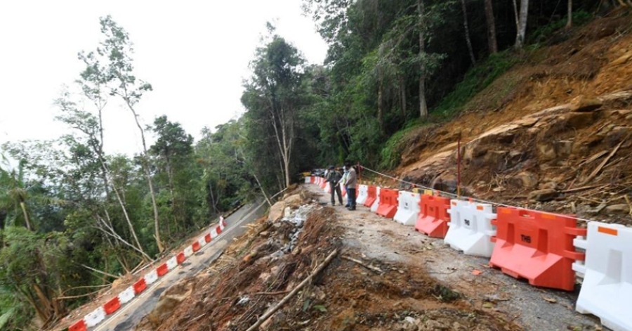
KUALA LUMPUR, Oct 27 — The Minerals and Geoscience Department is preparing the Gunung Jerai Slope Risk and Hazard Mapping Report which will be submitted to the National Disaster Management Agency (NADMA) on Nov 26.
This is following the tragic landslide and water surge phenomenon at Gunung Jerai last Aug 18 that caused massive flooding in the surrounding areas.
Energy and Natural Resources Deputy Minister, Datuk Ali Biju said the department was in the midst of identifying suitable sites at Gunung Jerai to develop a geological disaster early warning system.
“To date, the department has conducted the geological, geomorphological and geological engineering analyses to identify the slope locations at risk of collapsing and for water surge hazard mapping,” he said in the Dewan Rakyat today
This was in response to Sabri Azit (PAS-Jerai) who asked the government to state the mitigation actions taken at the level one disaster area in Gunung Jerai.
To a supplementary question from Nor Azrina Surip (PH-Merbok) on the cause of the disaster, Ali said it was due to the heavy rainfall during a short spell following a climate change phenomenon.
Sources: BERNAMA


Leave a Comment